
Knocknagantee [Cnoc na gCainte]
Good walks are even better shared.
Overview
Knocknagantee [Cnoc na gCainte]
Overview
Nestled in the picturesque Caha Mountains of County Cork, Knocknagantee, or Cnoc na gCainte, rises to an elevation of 710 meters. A hike to its summit not only offers a chance to stretch your legs but also promises majestic views of the stunning surrounding landscapes.
Geology
This mountain is composed mainly of sandstone and shale, making it a geologist's paradise. The layers tell stories of ancient environments, with the rocky outcrops showcasing intricate formations that have stood the test of time.
Routes
A popular route to reach the summit begins at the nearest parking area, a brisk walk away from Castletownbere. The journey is about 5.5 km, generally taking around 2.5 hours, depending on your pace and enthusiasm for taking photos along the way!
Summit Features
Upon reaching the summit, you'll be greeted by a large cairn topped with a stone cross, providing the perfect backdrop for a well-earned selfie. Grab your snacks, take a moment to enjoy the tranquillity, and perhaps try your hand at some light-hearted storytelling (preferably without encountering any ancient spirits!).
Terrain Type
Expect a mix of rocky pathways and grassy patches, interspersed with areas that can be boggier than a quick mudslide after a rainstorm. Proper footwear is advisable; no one wants squelchy socks, believe me!
Views
From the top, panoramic vistas unfold before you, with the shimmering Kenmare Bay and the distant Beara Peninsula on the horizon. The best seasons for these glorious views tend to be late spring and early summer, so pack your camera and prepare to be amazed!
Hazards
While the hike is generally quite accessible, watch out for loose rocks and always be prepared for unpredictable weather. Those boggy sections can turn into a luxury mud bath if you're not careful!
Nearby Summits
For the extra ambitious, consider exploring nearby peaks like Cnoc na gCainte, which stands at 690 meters, or the taller Knockboy at 706 meters. A summit-bagging adventure awaits!
Access
Parking is available at the foot of the eastern approach, and while public transport options are limited, the quaint village of Adrigole is not too far off. Castletownbere offers a selection of cafés and pubs to replenish your energy post-hike.
History
The name Knocknagantee, meaning 'Hill of the Talking,' hints at the rich folklore embedded in the local culture. It's said to be a place where stories were shared, reminiscent of times past.
So lace up your boots, grab your walking stick, and let the charm of Knocknagantee guide you on an unforgettable adventure!
Explore routes near Knocknagantee [Cnoc na gCainte]
Public walks starting within 80 km of this hill. Nearby does not mean a route reaches the summit; check its map and access before setting out.
No public routes are currently listed within 80 km of Knocknagantee [Cnoc na gCainte] on Walkmates. This does not mean there are no paths here. Explore the map and check local access information before planning a walk.
Route planning notes
These notes describe possible approaches, not verified navigable routes or permission to cross land. Check current paths, local access rules and conditions before setting out.
Cork to the Summit via the Eastern Approach
This route begins at the nearest parking area and ascends steadily through the rugged terrain, providing stunning views along the way.
Make a day of it, together
Find someone to share the walk with, or organise a day out along a route you like.
Hill facts and local notes
Classifications
Elevation
674m
2,212 ft
Prominence
102m
Coordinates
51.8937, -9.9357
V667729
OS Map
78 83
At the Summit
The summit features a large cairn marked by a stone cross, providing a scenic spot to take in the panoramic views.
Terrain & Geology
Knocknagantee is primarily composed of sandstone and shale, offering a diverse landscape of rocky outcrops, with intricate layers showcasing the geological history of the area.
Views & Scenery
From the summit, hikers can see the beautiful Kenmare Bay, the distant Beara Peninsula, and the surrounding rolling hills.
History & Heritage
Name Origin
Knocknagantee means 'Hill of the Talking' in Irish, possibly reflecting legendary associations with storytelling or meeting places.
Historical Significance
The area is rich in folklore, believed to be home to ancient tales of the Fianna and other mythical figures.
Getting There & Facilities
Check current local access restrictions, parking rules and transport timetables before travelling. These notes do not confirm public access to the summit.
Parking
The nearest parking is located at the foot of the eastern approach, with space for several vehicles.
Public Transport
Limited public transport options; the closest bus stops are in the village of Adrigole, approximately 8 km away.
Nearby Facilities
There are cafés and pubs in Castletownbere providing refreshments and public toilets. Always a good idea to fuel up before your adventure!
Safety Information
Known Hazards
- Loose rocks on the ascent, sudden changes in weather, and the potential for encountering boggy sections.
General Safety Tips
- Check weather conditions before setting out
- Carry appropriate clothing and equipment
- Let someone know your planned route
- Take a map, compass, and GPS device
- Carry emergency supplies: food, water, first aid kit, torch
Hills
Some common questions about the hills answered
Are there group walks up Knocknagantee [Cnoc na gCainte]?
Many walkers use Walkmates to join or organise walks with others. You can check for group walks around Knocknagantee [Cnoc na gCainte] through the maps
Are there other walkers around Knocknagantee [Cnoc na gCainte]?
Activity varies by location and time, but Walkmates lets you see whether others have shared walks or shown interest in this area. Find other people through the walking friends search walking friends for Knocknagantee [Cnoc na gCainte] search or of course create your own walk for Knocknagantee [Cnoc na gCainte]
Can I organise a walk to Knocknagantee [Cnoc na gCainte]?
Yes. If there aren’t any walks listed already, you can create a walk and make it available for others to join.
If you're signed up to Walkmates, you can create a walk to Knocknagantee [Cnoc na gCainte].
How do I find a walk up this hill?
There are often multiple ways to walk this hill, depending on experience and route preference. Walkmates helps you explore walks and routes that others have shared.
Can I suggest a new route up Knocknagantee [Cnoc na gCainte]?
Yes. You can suggest or create routes to share with others. Walkmates focuses on the social side of walking, so routes are used to help people organise walks and explore areas together, rather than as detailed navigation tools or route libraries.
Other uses really appreciate knowledgeable walkers sharing their routes. Share your favourite route to Knocknagantee [Cnoc na gCainte] here
The is an error or something incorrect about this hill. How do I let you know?
We always strive to keep the information on Walkmates as accurate as possible. If you find an error, please let us know through the contact form and we'll aim to correct it as quickly as possible
Community Discussion
Comments
Location
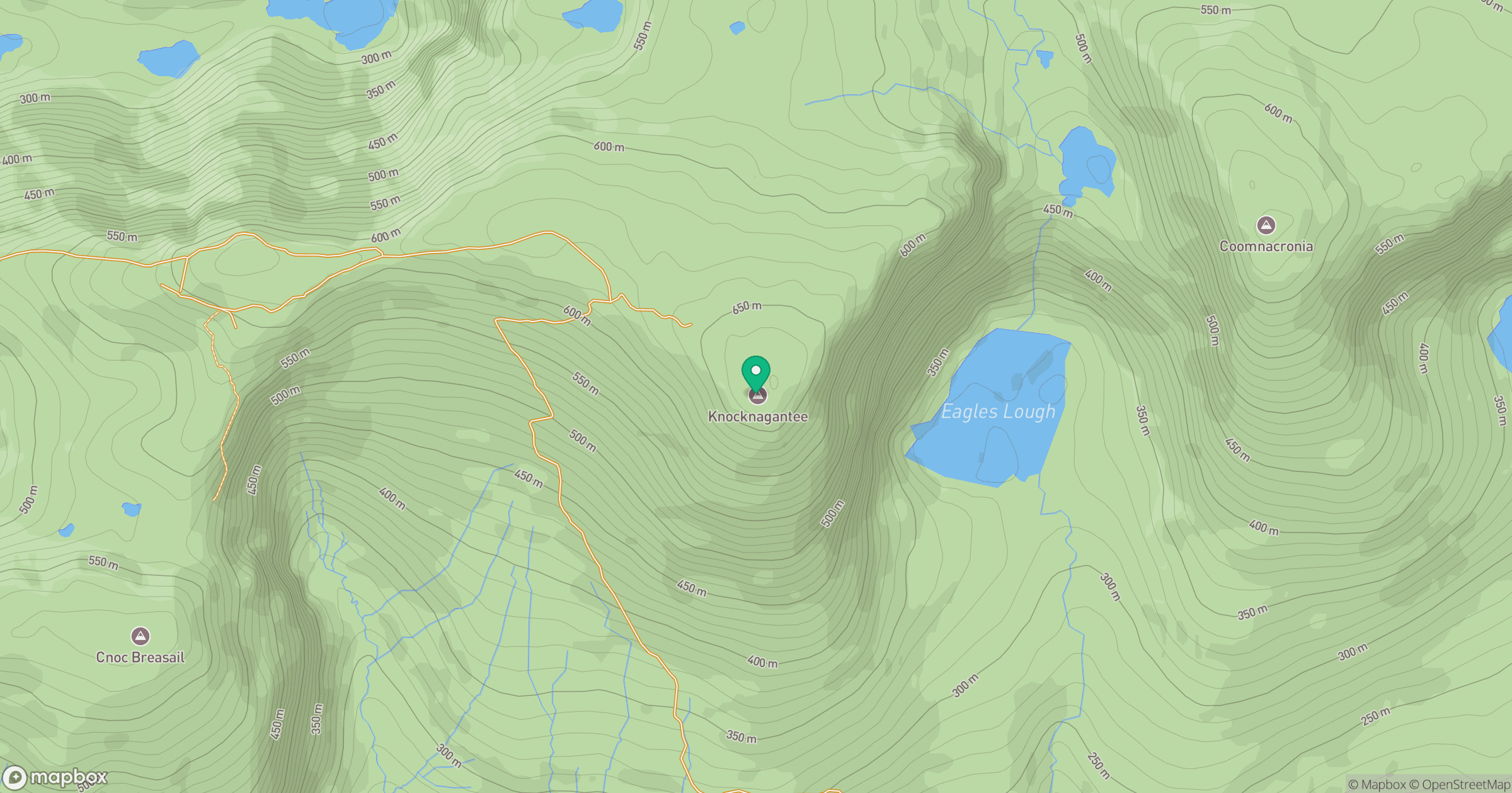
Grid reference: V667729
View on OpenStreetMapOpens a map in a new tab, centred on the hill.
Hills within 30 km
Straight-line distance, not a walking route or confirmation of access.
Carrauntoohil
1,039m
Knockmoyle [An Cnoc Maol]
682m
Slievenashaska [Sliabh na Seasca] [Coomcathcun]
578m
Knocknacusha [Cnoc Osaidh]
547m
Colly [An Bheann Mhor]
679m
No comments yet. Be the first.